Our design team took part in a challenge hosted by NASA in collaboration with South African National Space Agency to help solve global issues.
About the event
The NASA Space Apps Challenge is the largest annual hackathon for space and science in the world. The event welcomed more than 28 000 participants in over 162 countries to take on challenges that were created by NASA employees. The challenges brought forth some of NASA’s actual data and asked participants to create innovative solutions that will educate, inspire and solve real world problems.
Take Flight: Making the Most of Nasa’s Airborne Data
There was a list of challenges to choose from. We chose the “Take flight: Making the Most of Nasa’s Airborne Data”. This challenge was all about using the data Nasa supplied to solve real world problems.
Our solution was to design a platform where The Arctic-Boreal Vulnerability Experiment (ABoVE) data can be used by the public and businesses to predict the effect on the immediate and global climate. Once the projection has been done there will be educational opportunities to help inform what changes can be made to directly affect the driving factors.
Change the data and understand the impact
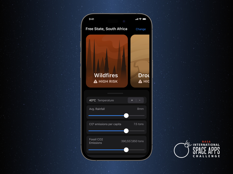
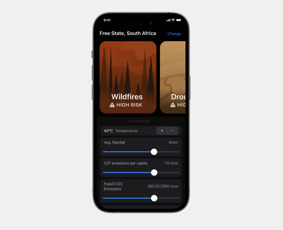
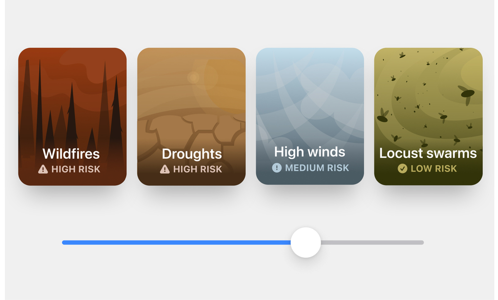
The interface enables users to choose a location and adjust metrics such as temperature, average rainfall, carbon emissions, fossil emissions and GDP per capita using steppers and sliders in a native iOS interface. Based on the metrics, the interface shows which natural disasters the area is at risk for such as wildfires, droughts, high winds, or locust swarms. Natural disasters are presented as ‘cards’ that include the risk rating of the disaster – such as high, medium or low risk.
The app is aimed at farmers who need to forecast weather patterns that could affect their crops and make them aware of the ideal plants to grow and procedures to follow in case a natural disaster at such a scale were to occur.
How it works
Step 1: Adjust the drivers
The user can adjust the drivers (temperature, precipitation, co2 and rainfall) in real-time to see how they will impact the environment. This is designed to be an educational tool that provides insight into environmental impacts such as wildfires, extreme temperatures and less precipitation.
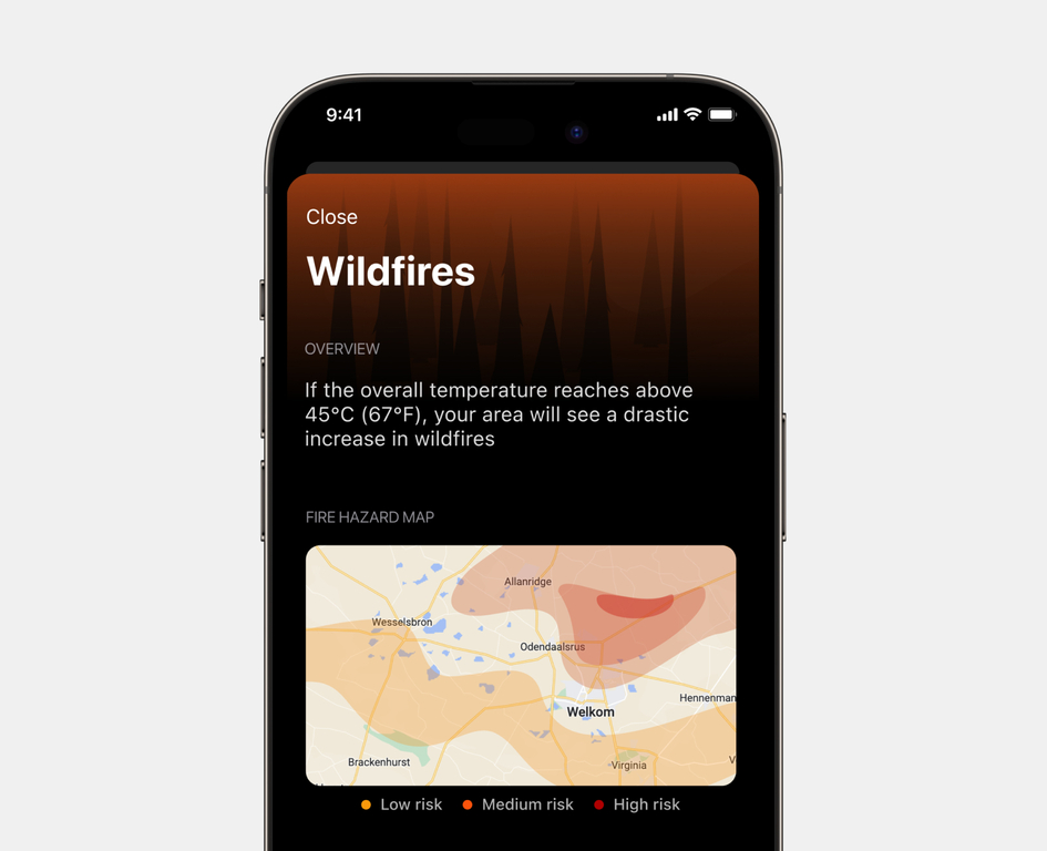
Step 2: Learn about the environmental impact
A user will be able to learn more about the environmental impact based on the drivers that have been adjusted. The information available will help explain how the impact affects their immediate environment as well as what can be done to mitigate it. This information is displayed in a map view of where the disaster is likely to occur, and further information provides a set of suggested crops that may thrive in those conditions.
Conclusion
At the end of the challenge our concept was presented back to the NASA and International Space App challenge team. As a result of our design concept, our team won the people choice award for our contribution during the NASA International Space Apps Challenge! Designing with data is an important part of creating meaningful digital experiences. It enables people to make decisions that positively impact their lives and the lives of those around them.
Tell us about your project
We believe that something amazing can come from combining your vision with our expertise.